


A powerful winter storm sets its sights on Blair, bringing an Arctic blast and significant snowfall. Here’s how things unfold:
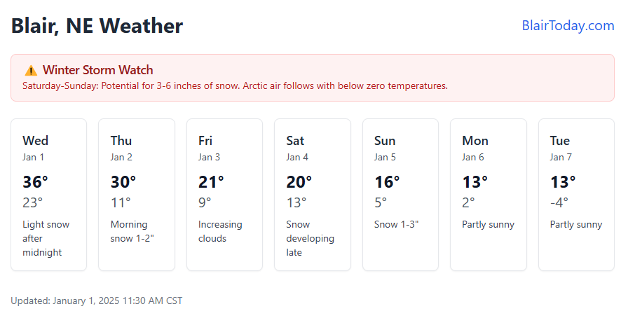
Evening, January 1 – Light snow arrives after midnight as temperatures dip to 23°F. Nothing major yet – just enough to dust the ground.
Thursday, January 2 – The morning commute gets tricky with 1-2 inches of fresh snow before the sun tries to peek through. High of 30°F, then clearing for a chilly night at 11°F.
Friday, January 3 – A deceptively quiet day starts sunny before clouds roll in. High of 21°F dropping to 9°F overnight.
Saturday, January 4 – This is when things get interesting. Clouds thicken ahead of our main event, with snow starting late. High of 20°F and overnight snow picking up. Bundle up – low of 13°F.
Sunday, January 5 – The heart of the storm. Snow piles up another 1-3 inches, pushing storm totals to half a foot in spots. Gusty north winds make the high of 16-19°F feel much colder.
Monday, January 6 – Storm’s gone but the cold isn’t. Partly sunny and a brisk 13-15°F. Evening clouds with a low of 2°F.
Tuesday, January 7 – The Arctic really settles in. Despite some sun, we’ll struggle to hit 13°F before dropping below zero overnight.
